Lahojsk (Lahoysk)
Lahoysk (Лаго́йск, ; Лого́йск, Łohojsk) is a city in the Minsk Region of Belarus and the administrative center of Lahoysk District.
First chronicled in 1078, Lahoysk was the centre of a small 12th-century principality, later absorbed into the Principality of Polotsk. In the 18th and 19th centuries, it was a seat of the Tyszkiewicz family.
In the 12th century it became the centre of its own duchy, the Duchy of Logozhsk. Since the 13th century it was part of the Grand Duchy of Lithuania. Under the name Logosko it was mentioned in the List of Ruthenian Cities Far and Near.
In different periods it came into the possession of Jagiello, Skirgaila, Vytautas and Czartoryski princes as well as of the Tyszkiewicz counts.
In 1505, in the war against the Crimean Khanate, the town was captured by the Tatars, plundered and burned. During the Northern War of 1700–1721 he was captured by Swedish forces. At the same time the Castle of Lahoysk was destroyed. In 1765 a Basilian monastery was built there.
As a result of the Second Partition of Poland in 1793, the town became part of the Russian Empire. In 1814–1819, the Tyszkiewicz family built a palace at Lahoysk, which was destroyed during the Second World War. According to some data, in 1842 brothers Konstanty and Eustachy Tyszkiewicz established an archaeological museum in Lahoysk. Its collection has served as the basis for the creation in 1855 of the Wilnius Archaeological Museum. In 1897, Lahoysk became the centre of a parish in the Barysau uyezd.
In 1890 the town had 1180 inhabitants, most of them Jews (685 persons). There was a synagogue, an Orthodox and a Catholic Church in the town.
In 1918 Lahoysk became part of the Belarusian Democratic Republic and later of the Belarusian Soviet Socialist Republic that was incorporated into the USSR.
Since 1924 Lahoysk is the centre of the Lahoysk District. In 1998, it was given the status of a city.
Map - Lahojsk (Lahoysk)
Map
Country - Belarus
 |
 |
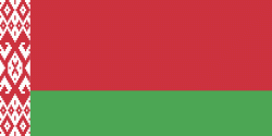
| Flag of Belarus | |
Until the 20th century, different states at various times controlled the lands of modern-day Belarus, including Kievan Rus', the Principality of Polotsk, the Grand Duchy of Lithuania, the Polish–Lithuanian Commonwealth, and the Russian Empire. In the aftermath of the Russian Revolution in 1917, different states arose competing for legitimacy amid the Civil War, ultimately ending in the rise of the Byelorussian SSR, which became a founding constituent republic of the Soviet Union in 1922. After the Polish-Soviet War, Belarus lost almost half of its territory to Poland. Much of the borders of Belarus took their modern shape in 1939, when some lands of the Second Polish Republic were reintegrated into it after the Soviet invasion of Poland, and were finalized after World War II. During World War II, military operations devastated Belarus, which lost about a quarter of its population and half of its economic resources. The republic was redeveloped in the post-war years. In 1945, the Byelorussian SSR became a founding member of the United Nations, along with the Soviet Union.
Currency / Language
| ISO | Currency | Symbol | Significant figures |
|---|---|---|---|
| BYN | Belarusian ruble | Br | 2 |
| ISO | Language |
|---|---|
| BE | Belarusian language |
| RU | Russian language |


